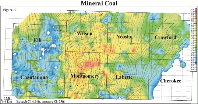
An Isopach map is a form of and Isoline map that uses lines to illustrate variations of thickness. The contour lines of isopachs represent lines of equal thickness of a quality of the land within a tabular unit or stratum. In the map below, isopachs are employed to display the varying layers of thickness in mineral coal throughout a region.
No comments:
Post a Comment