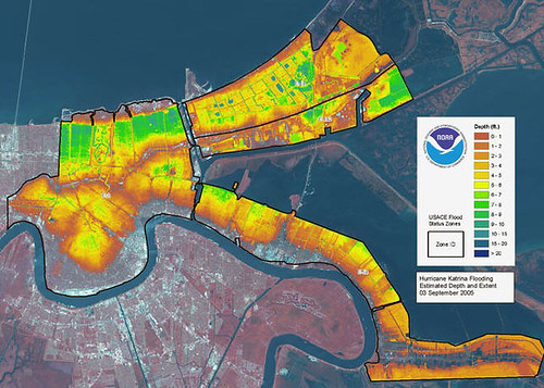
LIDAR, also known as LADAR maps employ remote sensing technology in order to measure properties such as distance of a target area of land by illumination. Light Detection and Ranging technology uses pulses from a LASER and is sometimes called "LASER radar" in military contexts. The example of a LIDAR map below shows the flooding of New Orleans as a result of hurricane Katrina. Using infrared satellite and LASER technology, scientists can observe to what extent and depths the flooding reached throughout the city, making this technology and style of mapping a vital tool in natural disaster search and rescue situations.
No comments:
Post a Comment